
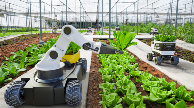
GPS has become a vital tool of American precision agriculture, integrated into almost every aspect of this $2.3 trillion industry. In this article, we will take a look at the ways that modern farmers use GPS.
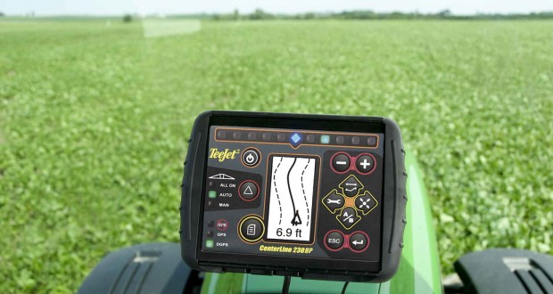
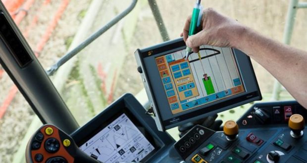
Machinery Direction with GPS
Really great tractor operators can use their exceptional vision and steadiness to plant crops in straight lines that extend for a mile or more. GPS-enabled tractors can achieve equally precise rows and also adjust the depth and number of seeds planted to soil conditions and prior year fertilizer application.
Soil Mapping with GPS
source: precisionagricultu.re
Soils are not always uniform across a field. GPS allows farmers to map precise locations where soils need more or less fertilizer, so GPS-enabled fertilizer rigs can adjust applications for maximum yields and optimum profitability.
On a broader scale, Agricultural Extension offices maintain maps of soil types for entire counties and states. This data used to be collected by going out into the field with surveyor instruments or inferred from aerial photography. With GPS, soil maps on the county and state level can be drawn more precisely with less time collecting soil samples.,
Weed Mapping with GPS
Weeds seldom take over an entire field. GPS enables farmers to apply herbicides where they are needed, avoiding waste of expensive chemicals on parts of a field that are weed-free.
Accurate Planting with GPS
Some parts of a field support more plants, while other parts of a field support fewer plants. GPS-enabled seeders adjust the rate at which they release seed to the optimum level for extremely localized soil and moisture conditions.
Seed Planting Distance and Depth with GPS
Planting seed just a millimeter higher or lower in the soil and spacing seed just a millimeter closer or farther apart can have a significant effect on crop yields. GPS data mapped to field conditions allows precision seeding equipment to adjust depth and spacing for maximum yields.
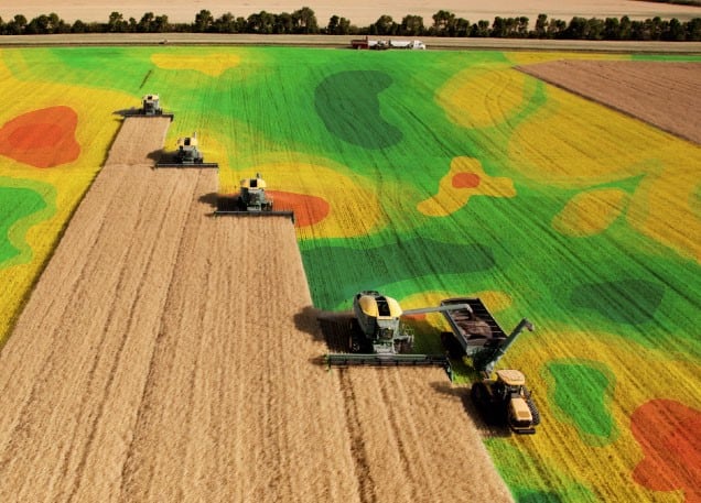
Creation of Yield Maps with GPS
source: farmmanagement.pro
Farmers don’t just sell crops. They more typically sell futures, contracts to deliver a certain amount of a crop at a specified date at the end of the next growing season. GPS-created yield maps give them a tool for computing a range of possible yields given various combinations of temperatures and precipitation, which they in turn can use to calculate how much they will be able to deliver under contract, and how much financing they can get for the next year’s crop.
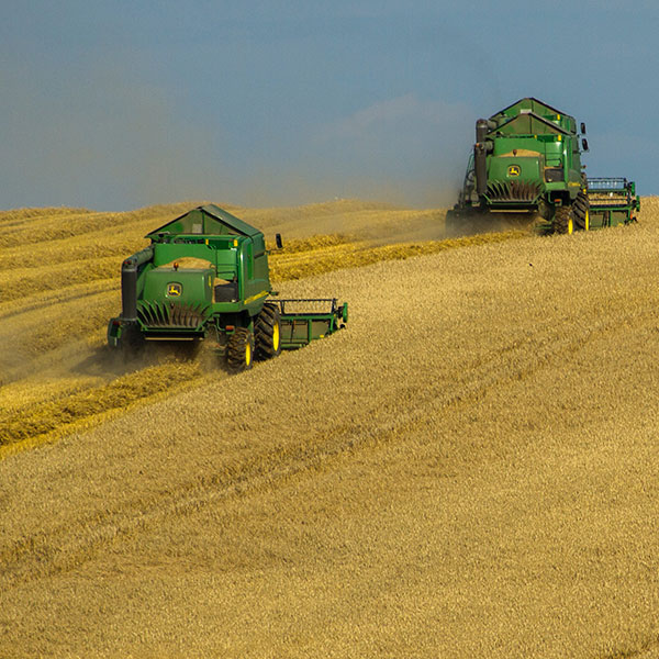
Documentation of Harvest Amounts with GPS
Modern combines count each seed as it comes into the storage unit. They can correlate the number of seeds they receive with the location where they were harvested to within 5 meters, about 15 feet. This provides data that farmers can use to create harvest maps, telling them how to expect to grow on different fields and in different parts of those fields.
Minimizing Environmental Impact of Pesticides with GPS
Some pesticides drift into the watershed. GPS-enabled sprayers can reduce or stop the release of pesticides over portions of a field that drain directly into a nearby body of water.
Crop Scouting for the Local Extension Office with GPS
source: smallfarms.cornell.edu
County extension agents make visual inspections of crops at various stages of growth in the counties they serve. GPS coordinates for the observed boundaries of a field allow them to calculate the acreage under cultivation for various kinds of crops. They can then use this information to predict yields, informing farmers and buyers alike of changes that can affect prices.
Correlation of Agricultural Methods with Crop Yields with GPS
How much does a low-till or no-till approach change yields? Are three sprayings with a pesticide really more profitable than two? What is the difference between two new hybrids in terms of their yield? GPS geolocation data gives farmers and extension agents the data they need to compare agricultural methods and different strains of plants in terms of yield and profitability.
Assessment of Water Resources with GPS
GPS mapping can calculate the distance of a field from its irrigation sources with a precision of about half a yard. Farmers can use this information to compute exactly the amount of pipe, connectors, and labor they will need to connect to their water supply. GPS can also track fluctuations in water reservoirs to allow for exact computation of water available.
Identifying Irrigated Crops with GPS
source: pinterest.com
Farmers, farm managers, and extension agents can use GPS to record the exact boundaries of irrigated and non-irrigated growing areas. This information can then be used in water release planning for the rest of the growing season.
Identifying Wet Soils, Bogs, and Flood Plains with GPS
GPS coordinates enable farmers and potential buyers of farmland to identify and measure areas that may retain too much water for regular cultivation. GPS also gives precise locations of 50-, 100-, 500-, and 1000-year floodplains for planning construction.
Contour Mapping with GPS
Many farmers build terraces along the contours of their fields to prevent soil from washing away. GPS coordinates tell the bulldozer operator exactly where to push dirt to build the most effective terraces.
Meteorological Mapping with GPS

source: pinterest.com
GPS coordinates impart additional meaning to automatic reports from rain gauges and thermometers. This data tells farmers the exact locations where additional attention for protecting crops or livestock may be necessary.
Personnel Monitoring with GPS
GPS coordinates tell farmers and their families where workers are on the farm at all times. This makes emergency response possible in case of an accident.
Equipment Security with GPS
Farm equipment can cost tens of thousands or even hundreds of thousands of dollars. GPS tracking makes retrieval more likely in case of theft and lowers insurance costs in the meantime.
GPS tracking devices have become standard on new agricultural equipment, but many older machines need to be retrofitted.